 |
Holwell |
|
|
|
Holwell |
|
 |
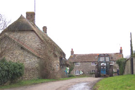
Holwell is a parish and
scattered village
sited on Oxford Clay in the Blackmore Vale 6 miles south east of Sherborne. It was formerly a detached part of Somerset,
until it was transferred to Dorset in October 1844. Caundle Brook, a small stream,
the principle tributary of the River Lydden, flows through the northern
part of the parish and here was located the original medieval settlement. It contains the church,
a large early 18th century rectory and a few stone cottages, a thatched store, and an inn on the cross roads by Crouch Hill.
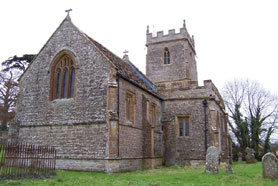
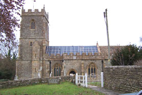
Known as The Borough it forms a perfect little hamlet. The church of St Lawrence, which was restored in 1885 is stone built and comprises
chancel, nave, aisles, south porch and square embattled tower. The registers date from the year 1653. |
A parochial school was built in
1874 for 80 children and there was a post office and Wesleyan chapel. The parish extends to
2342 acres with the soil mainly clay, the land being used mainly for
pasture. Higher and Lower Buckshawe form a hamlet one mile south west,
Crouch Hill one mile south and Woodbridge two miles north east. The
population in 1891 was 377 persons. |
 |
|
The new Online Parish Clerk (OPC) for Holwell is Kim Parker |
|
| Census |
1841 Census [Kim Parker] 1851 Census [John Ridout] 1861 Census [Caryl Parsons] 1871 Census [Kim Parker] 1881 Census [Terry Smith] 1891 Census |
| Parish Registers |
Baptisms
1653-1780,
1781-1840,
1841-1888 Marriages 1655-1726, 1727-1836, 1837-1910 Burials 1653-1726, 1727-1795, 1796-1850, 1851-1930 Register Notes |
| Parish Chest |
Holwell Poor Rate 1755 Holwell Vestry Book Extracts 1750-1873 |
| Land Records | Holwell Tithes 1776, 1789 |
| Monumental Inscriptions | Monumental Inscriptions index |
| School Records |
School Subscription
1870-1874 School Admissions Register 1886-1922 School Log Book 1875-1902 1902-1922 School Managers Minute Book 1903-1949 |
| Directories | 1859, 1885, 1903 & 1923 |
| Military Record | Holwell Militia List 1799 |
| Miscellaneous Records |
Holwell Petition 1884 See also; Name extracts from Woodbridge Estate Survey in 1762 in the parishes of Holwell, Lydlinch, Stock Gaylard, Caundle Bishop, Caundle Marsh. etc. |
| Resources | Holwell Information at Dorset History Centre |
| Maps | The 1891 Ordnance Survey maps of the parish can be seen at the old-maps site, just enter 'Holwell' under place search. |
|
View Larger Map |
|
| Records held at the Dorset History Centre |
Registers Christenings 1653-1888. Marriages 1655-1992. Burials 1653-1970. |
|
|
|
|
|
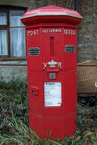
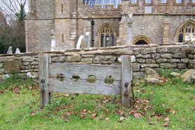
Photos (left to right): East end of the church, the old Victorian post
box at Barnes Cross and the stocks just outside the churchyard |
Visitors to Dorset OPC
Copyright (c) 2025 Dorset OPC Project