 |
Bradpole |
 |
 |
Bradpole |
 |
 Old postcard of Bradpole showing the Vicarage and the Forster Institute |
Bradpole is a parish partly within the borough of Bridport and 5 miles south from Beaminster. The church of the Holy Trinity is in the Early English style and consists of a chancel, nave, north aisle, tower & spire. There is no manor. The workhouse for Bridport Union is within this parish. The chief crops are wheat, oats and grass. The population in 1871 was 1,549. There is a National School. Details extracted from the 1880 Kelly's Directory. |
|
The OPC for Bradpole is Colin Barrett
|
|
| Census | 1841 Census - District 8 [Lorraine Key] 1841 Census - District 9 [Lorraine Key] 1851 Census - District 2 [Lorraine Key] 1851 Census - District 3 [Lorraine Key] 1871 Census - District 3 [John Ridout] 1871 Census - District 4 [John Ridout] |
| Parish Registers | The
Parish Registers date from 1695 Bishop's Transcripts are available from 1731 Baptisms 1813-1816 [Jan Hibberd] Marriages 1695-1812 [Lorraine Key] Burials 1813-1837 [Jan Hibberd] |
| Directorys | Extracts from Directories 1865 & 1880 [Lorraine Key] |
| Maps | The 1891 Ordnance Survey maps of the parish can be seen at the old-maps site, just enter 'Bradpole' under place search. |
 |
For modern
location maps visit:-
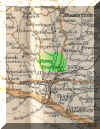
For a 1920's map of the area click on the thumbnail opposite |
Visitors to Dorset OPC
Copyright (c) 2025 Dorset OPC Project