Toller Porcorum
alias Great Toller
|
Toller Porcorumalias Great Toller |
|
|
|
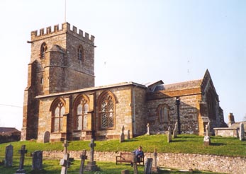
The parish of Toller
Porcorum, also known as Great Toller, is located 10 miles
west-north-west of Dorchester on a tributary of the River Frome. It includes
Higher & Lower
Kingcombe. The church of St Peter, a building
of stone is in the Norman style. It used to contain two galleries, one
of which was erected specifically for the school children, but these
were removed in 1895 when the church was restored. There are seats for
150 persons. The registers date from 1615, but unfortunately those prior
to 1758 have not survived. |
||||||||
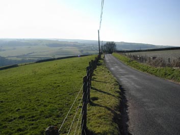
Nearby hamlets include Frogmoor which is to the south-east, Barrow-Land 1 mile south-west and Woolcombe 1½ miles south. Higher & Lower Kingcombe (or Kentiscombe) is a tithing belonging to Toller Porcorum one mile north-east. The soil is strong clay and is chiefly pasture covering an area of 3,144 acres. In 1861 the population was 500, with 417 persons in 1891. |
|
||||||||
The Online Parish Clerks (OPC) for Toller Porcorum are
Carol Few and Pat Leech |
|||||||||
| Census |
1841 Census 1851 Census [John Ridout] 1861 Census 1871 Census 1881 Census [Terry Smith] Transcriptions of other census are always very welcome |
||||||||
| Parish Registers | These are being transcribed the
following are on-line so far: Baptisms 1615-1658 [Nevill & Bartelott] [Kim Parker] Baptisms 1732-1757, 1758-1812, 1813-1880 [PRs][Kim Parker] Baptisms 1748-1876 [BTs - Extracts] Marriages 1615-1812 [Phillimores] 1813-1880 [PR] [Kim Parker] Burials 1615-1658 [Nevill & Bartelott] [Kim Parker] Burials 1732-1758 [BTs] 1813-1910 [PRs] [Kim Parker] |
||||||||
| Postal Directories | |||||||||
| Photographs | Photographs of church, village & countryside | ||||||||
| Links |
Welcome to
Toller Porcorum [external site, opens in new window] Toller Porcorum a West Dorset Village [external site, opens in new window] |
||||||||
| Maps | The 1891 Ordnance Survey maps of the parish can be seen at the old-maps site, just enter 'Toller Porcorum' under place search. | ||||||||
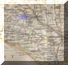 |
For modern
location maps visit:- |
||||||||
|
View Larger Map |
|||||||||
| Parish Records held at the Dorset History Centre, Dorchester |
|
||||||||
Visitors to Dorset OPC
Copyright (c) 2025 Dorset OPC Project