 |
The Tarrant ParishesTarrant Crawford, Tarrant Gunville, Tarrant Hinton, Tarrant Keynston, Tarrant Rawston, Tarrant Rushton |
|
|
The Tarrant ParishesTarrant Crawford, Tarrant Gunville, Tarrant Hinton, Tarrant Keynston, Tarrant Rawston, Tarrant Rushton |
|
|
|
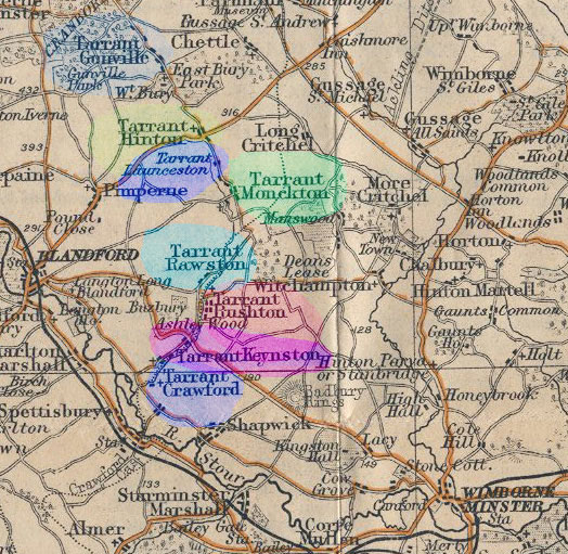
The Tarrant is a tributary of the River
Stour, it springs from the base of Cranborne Chase and just above it
source is the village of Tarrant Gunville, as the stream flows south
east you come to Tarrant Hinton, Tarrant Launceston and Tarrant Monkton.
Shortly after Monkton the stream turns and heads south west towards the
Stour. It passes the villages of Tarrant Rawston and Tarrant Rushton,
then Tarrant Keynston. Tarrant Crawford is the most southerly village
along its route, situated close to the Stour. |
The parishes are small ranging in area from 543 acres (Crawford) to 3431 acres (Gunville). The soil tends to be chalky and the main crops used to be wheat, barley and oats. The population in 1891 was as follows: Crawford 41, Gunville 369, Hinton 213, Keynston 260, Launceston 61, Monkton 219, Rawston 49, and Rushton 177 persons. There used to be schools in Hinton, Keynston, Monkton and Rushton. |
|
|
We have OPCs for five of the Tarrants Most of the Bishops Transcripts have been kindly donated by Christine Crawford. Many of the census transcripts courtesy of Royston Clarke. If you would be interested in increasing this data or being the OPC for one of the vacant parishes, please contact the Co-ordinater. [Link on the OPC Page] |
|
| CENSUS |
1861
for Tarrant Hinton 1881 for Tarrant Hinton |
|
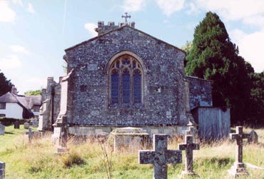
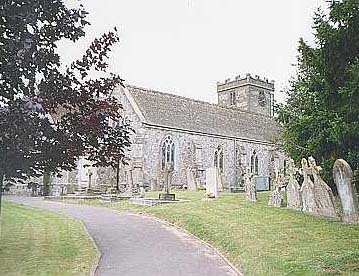
TARRANT HINTON Church of St Mary |
Baptisms
1545-1699 & 1700-1812 Marriages & Banns 1545-1812 Burials 1545-1812 |
| MISCELLANEOUS RECORDS |
Tarrant Hinton Protestation Returns 1641 Kelly's Directory's 1855, 1867, 1875, 1880, 1895, 1935 Post Office Directory 1855, 1859, 1889, 1911, 1915 |
| PHOTOGRAPHS | For Photographs of Tarrant Crawford, Hinton and Keynston. |
| MAPS | The 1891 ordnance survey maps of the parish can be seen at the old-maps site, just enter the appropriate name under place search. |
 |
For modern location maps visit
www.multimap.com For a 1920s map showing the location of all the Tarrants click on the thumbnail on the left [134Kb] |
Visitors to Dorset OPC
Copyright (c) 2024 Dorset OPC Project