 |
Kimmeridge |
|
|
Kimmeridge |
|
|
Kimmeridge is a parish on the
south coast on the Isle of Purbeck about 10 miles south from Wareham.
The parishes of Steeple and
Church Knowle are to the west and north with
Corfe Castle to the
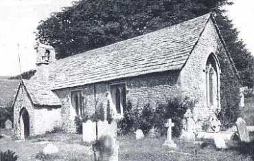
east. The church, dedicated to St Nicholas, is
small and plain and parts of it are about 800 years old. Within are
memorials to the Clavells of Smedmore. The registers date from 1694. The
geological structure of the coast is interesting and the bituminous
shale found here burns with a strong light.
|
|
|
|
One of the chief employers in the parish in the 19th
century was the Coastguard Station. There was a Post Office and
telegraph office and a National School which was built in 1866. The
parish comprises 1570 acres which is mainly clay and is laid to pasture.
The population in 1841 was 154, in 1861 it was 185, in 1881 there were
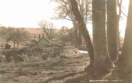
171 and in 1901 it was down to 126. Photographs from old postcards and text extracted from Kelly's Directory for 1895. Postcard on the left is circa 1910. |
The OPC for Kimmeridge is
Louise Haywood |
|
| Census |
1841, 1851, & 1861 Census 1871, 1881, 1891 & 1901 Census [Antony Lambert] 1911 Census [Antony Lambert] 1939 Register Part 1 (WLKJ), 1939 Register Part 2 (WLKK) [External] |
| Parish
Registers |
Baptisms 1684-1841 [Barry Chinchen] Marriages 1702-1840 [Barry Chinchen] Burials 1701-1841 [Barry Chinchen] |
| Postal Directories | |
| Monumental Inscriptions | St Nicholas Monumental Inscriptions index [Jan Hibberd] |
| Other Records |
Lay Subsidy Roll 1327 & 1332 Poll Tax of 1381 Tudor Subsidies 1523-1593 Tudor Muster Rolls 1539 & 1569 Protestation Return 1641-2 Hearth Tax Assessment 1662 |
| Links |
Kimmeridge Alum Works [External site] Kimmeridge Shale [External site - Archive] Kimmeridge Oil Shale [External - Academic site with excellent photographs and maps] |
| Maps | |
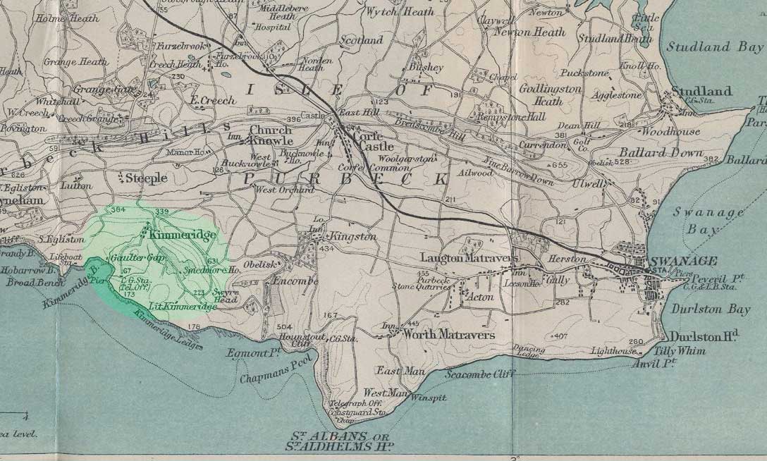 |
For a 1920s map of the area, click on the thumbnail on the left. |
|
View Larger Map |
|
| Records held at the Dorset History Centre | Registers Christenings 1684-1808. Marriages 1702-1977. Burials 1701-1812. |
Visitors to Dorset OPC
Copyright (c) 2025 Dorset OPC Project