Hanford
|
Hanford |
|
|
Hanford is a small parish on the River Stour, 4½ miles NW of Blandford.
The Parish covering only 600 acres, lies across the Chalk saddle between Hambledon and Hod Hills, which reach altitudes of 600 ft. and 450 ft. respectively in the N. and S.E. extremities of the area. The former village lay at the junction of the Chalk and the upper Greensand, overlooking the river. The manor at one time belonged to Tarrent nunnery, and later belonged to the Seymer family. |
|
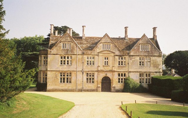
Hanford House (right) is set on ground which falls away to South and East to the Stour, about ¼ m. away. The mansion has stone walls and is roofed with stone-slates; it has two principal storeys with attics and cellars and is planned around a square courtyard, on the model of an Italian palace. It was built for Sir Robert Seymer between 1604 and 1623. Nowadays it is the home of Hanford Preparatory School for Girls.
|
|
|
|
| Census |
1841 Census [with Child Okeford] 1851 Census [with Stourpaine] 1861 Census [with Stourpaine] 1871 Census 1881 Census 1891 Census 1901 Census 1911 Census [with Child Okeford] |
| Parish Registers |
Baptisms 1832-1954 Marriages 1815-1949 Burials 1815-1918 Banns 1862-1949 |
| Trade & Postal Directories | |
| Other Records | |
| Photographs | |
| Monumental Inscriptions | |
| Maps | |
|
View Larger Map |
|
| Records held at the Dorset History Centre [Ref PE-HAN] |
Registers Christenings 1832-1954. Marriages 1815-1835, 1847-1949. Burials 1815, 1828-1874, 1918. Banns 1862-1949 |
| Registration District
(for the purpose of civil registration births, marriages, deaths & civil partnerships) |
1 Jul 1837-20 May 1862: Blandford 21 May 1862-31 Mar 1974: Sturminster 1 Apr 1974-17 Oct 2005: North Dorset |
|
|
|
Visitors to Dorset OPC
Copyright (c) 2024 Dorset OPC Project